

Burstall Pass Trail - Smith Dorrien Trail
5/5
★
based on 8 reviews
About Burstall Pass Trail
Cypress Hills Provincial Park
 Beach
Beach Birding
 Camping
 Canoeing/Kayaking
 Cross Country Skiing
 Downhill Skiing
 Equestrian
 FatBiking
 Fishing
 Geocaching
 Golfing
 Group Use
 Hiking - Front Country
 Hiking - Interpretive
 Horseshoes
 Hunting
 Ice Fishing
 Ice Skating
 Mtn. Biking/Cycling
 Power Boating
 Sailing
 Snowshoeing
 Swimming
 Tobogganing
 Water Skiing
 Wildlife Viewing
 Wind Surfing
 Winter Camping
 Day Use
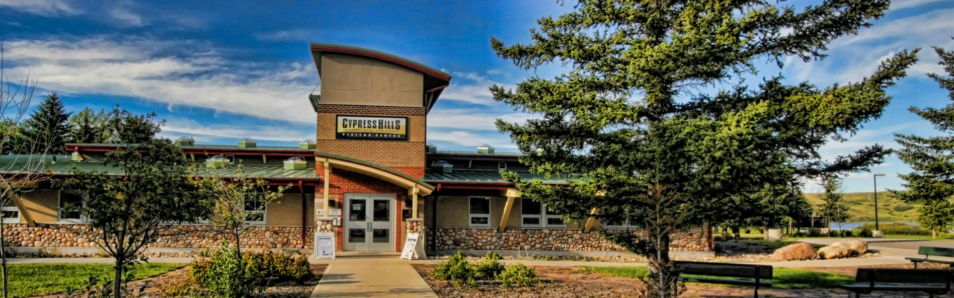
Contact Burstall Pass Trail
| Address : | Highway 742, Smith Dorrien Trail, AB, Canada |
| Website : | http://www.albertaparks.ca/ |
| Categories : |

|
S
|
Scott Perley on Google
★ ★ ★ ★ ★ Stunning scenery the whole way along. Need more signage at the beginning as we weren't the only ones to miss the trail and have to make a 1k detour away from French Glacier
|
|
Y
|
Y p on Google
★ ★ ★ ★ ★ Hiked it in July. Beautiful and not difficult technically or physically. Trailhead easy to find with signage. Lots of bugs and Shallow creek crossings.
|
|
E
|
Ev Benson on Google
★ ★ ★ ★ ★ Went 3 weeks ago. Cold & sunny snowshoeing to the meadows & back. Packed trail but snowshoes came in handy in a lot of areas. Did not go past the meadows, as that is avalanche terrain. Nice day!
|
|
S
|
Samuel Leung on Google
★ ★ ★ ★ ★ Cool hike! Great views of the mountains at the pass!
|
|
J
|
John Allin on Google
★ ★ ★ ★ ★ A great hike thru Burstall Pass into Banff NP. Scenery is everywhere, from the flatish forest path, thru alluvial plains (bring water shoes), then start the climb up to mountain vistas. Not a hard hike but may be too long, in & out trail, for people not in good shape. If you sneak into Banff Park it could easily add over ten more km to your day.
|
|
i
|
im_a_bored_james on Google
★ ★ ★ ★ ★ Absolutely amazing hike. When I did last year the creek running through the trail was quite large, resulting in a large portion of the trail being flooded and difficult to cross. Using some fallen logs I was able to make it across but on the way out did get wet. Would recommend doing this hike towards the end of summer, maybe into the fall. Creek would likely be lower at that time.
|
|
A
|
Andrea Wu on Google
★ ★ ★ ★ ★ Came here on a Sunday morning around 8:40AM, not many cars parked. Started the hike 5 minutes to 9AM, first part is pretty flat and then after the stream area, the hike goes into the trees and starts going uphill. Not too bad but pretty muddy in a lot of spots. View at the top was pretty great, lots of mountains and larches! Took about 2 hours to get up, saw lots of people on the way down, many cars in the parking lot by the time we got down close to 2PM.
|
|
J
|
Juni Perberry on Google
★ ★ ★ ★ ★ It's a great hike but it's definitely worth it to wait until July as there are still muddy and snowy sections this late in June. The Burstall River was too flooded to cross at this point in the year; we turned around at this point. It was still an incredible and easy hike to do. It's important to note that the trail goes off to the right in the 2nd photo I've posted, fairly soon after starting the hike. We initially followed the well-groomed rock path which didn't lead to a trail. It lead to Frenchman's Creek.
|
Write some of your reviews for the company Burstall Pass Trail
Your reviews will be very helpful to other customers in finding and evaluating information
Nearby places in the field of Hiking area,


Nearby places Burstall Pass Trail


